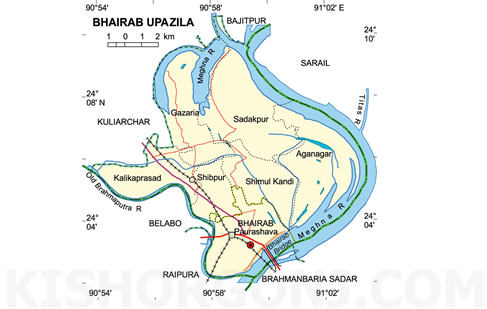
Bhairab Upazila (kishoreganj district) with an area of 139.32 sq km is bounded by bajitpur upazila and meghna river on the north, raipur and brahmanbaria sadar upazilas on the south, sarail upazila and Meghna river on the east, kuliarchar and elabo upazilas on the west. Bhairab is called the Meghna-Bhramaputra delta. Main rivers are Meghna, old brahmaputra.
Bhairab (Town) stands on the bank of the Meghna. Bhairab municipality was established in 1958. It has an area of 15.31 sq km. It has a population of 91913; male 51.92%, female 48.08%. It has 12 wards and 24 mahallas. Literacy rate among the town people is 39.7%. The town has 5 dakbungalows.
Administration Bhairab thana was established in 1906 and was turned into an upazila in 1983. It consists of one municipality, six union parishads, 41 mouzas and 79 villages.
Historical events During the war of liberation in 1971 the Pakistan army killed about three hundred people at Halgara of the upazila.
Marks of War of Liberation Memorials sculpture (sixty feet high) 'Durjay Bhairab' is under construction.
Population 192448; male 51.11%, female 48.89%; Muslim 95.18%, Hindu 4.71%, Christian 0.02%, Buddhist 0.01% and others 0.08%.
Religious institutions Mosque 208, tomb 13 and temple 7.
Literacy and educational institutions Average literacy 22.1%; male 27.8%, female 16.4%. Educational institutions: college 5, high school 15, madrasa 6, government primary school 58, non-government primary school 17, technical training centre 1, social welfare training centre 2. Noted institutions: Jagannathpur Old Primary School (1895), Hazi Asmat College (1947), K B High School (1919)
Locally published newspapers and periodicals Weekly Mufassalchitra and weekly Nirapekha Arunima.
Cultural organisations Public library 6, theatre group 4, drama stage 1, cinema hall 3, voluntary association 65, women's organisation 3, literary society 3.
Main occupations Agriculture 31.37%, fishing 2.73%, agricultural labourer 9.68%, wage labourer 5.13%, industry 1.98%, commerce 19.52%, hawker 2.19%, transport 4.03%, construction 1.38%, service 9.01%, others 12.98%.
Land use Total cultivable land 9590.86 hectares, fallow land 60 hectares; single crop 56.54%, double crop 39.36%, treble crop 4.10%; land under irrigation 4019.83 hectares.
Land control Among the peasants 12.16% are landless, 30.37% marginal, 51.27% small, 5.19% intermediate and 1.01% rich.
Value of land The market value of the land of the first grade is about Tk 10000 per 0.01 hectare.
Main crops Paddy, mustard seed, potato, pulse, sesame, peanut, chilli, coriander.
Extinct or nearly extinct crops Jute, karpus.
Main fruits Mango, black berry, banana, guava.
Fisheries, dairies, poultries Dairy 38, poultry 77, fishery 4, hatchery 1.
Communication facilities Roads: pucca 50 km, semi pucca 1 km and mud road 55; railways: 13.11 km; waterways 17 nautical mile.
Traditional transport Palanquin (extinct) and sailing boat.
Manufactories Jute mill 1, iron (tarkata) mill 2, welding 37.
Cottage industries Blacksmith 40, potteries 7, goldsmith 42.
Hats, bazars and fairs Total number of hats and bazars are 13, the most noted of which are Bhairab, Shimul Kandi, Gazaria, Chawkbazar; fairs 4, most noted Fakir Bari Mela, Siddique Bazar Mela.
Main exports Fish, coil, iron, bidi, shoe, biscuit, lungi, gamcha.
NGO activities Operationally important NGOs are CARE, brac, asa, proshika, Global Village, Need.
Health centres Upazila health complex 1, family welfare centre 5, sub health centre 2, railway hospital 1. [Sharif Ahmed]