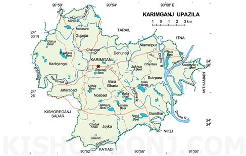
Karimganj Upazila (kishoreganj district) with an area of 200.52 sq km, is bounded by tarail upazila on the north, nikli and katiadi upazilas on the south, itna and mithamain upazilas on the east, kishoreganj sadar upazila on the west. Main rivers are Narsunda, Bathail, Singua, Dhanu. Notable beels are Balia, Naoli, Beel Bara, Ukhla, Chhotaharia, Kolai.
Karimganj (Town) consists of four mouzas. It has an area of 6.21 km and a population of 14440; male 51.36%, female 48.64%. The density of population is 2325 per sq km. Literacy rate among the town people is 34.5%.
Administration Karimganj thana was established in 1932 and was turned into an upazila in 1985. It consists of 11 union parishads, 85 mouzas and 184 villages.
Archaeological heritage and relics Jangalbari Fort (sixteenth century), Isa Khan Shahi Mosque (sixteenth century), Palace of Isa Khan.
Historical events Isa Khan, Chief of the Bara Bhuiyans, surprised Jangalbari and occupied it defeating Koch King Laxan Hajo who ran away. Isa Khan established his second capital at Jangalbari.
Marks of War of Liberation Mass grave at village Boira of Joisindhu.
Population 237155; male 49.75%, female 50.25%; Muslim 96.94%, Hindu 2.55%, Buddhist 0.09%, Christian 0.09% and others 0.33%.
Religious institutions Mosque 550, temple 8.
Literacy and educational institutions Average literacy 20.3%, male 25.3% and female 15.3%. Educational institutions: college 3, high school 14, junior high school 3, madrasa 15, government primary school 84, non-government primary school 32, satellite school 4; noted institution: Jangalbari English School (1862), and Gujadia Abdul Hekim High School.
Newspaper Extinct periodicals: Suchana (1981), Shadhin Barta (1988), Isha Kha (1988-1991), Shahoser padabali (1992).
Cultural organisations Club 39, cinema hall 3, drama stage 1, theatre group 10, playground 21, women's organisation 1 and children park 1.
Main occupations Agriculture 42.38%, agricultural labourer 24.7%, wage labourer 2.78%, fishing 1.59%, transport 2.35%, service 2.88%, commerce 12.9%, others 10.42%.
Land use Total cultivable land 14870 hectares, fallow land 2.93 hectares; single crop 22%, double crop 57% and treble crop 21%. Cultivable land under irrigation 85%.
Land control Among the peasants, 34% are landless, 49% marginal and small, 14% intermediate and 3% rich.
Value of land The market value of the land of the first grade is about Tk 2500 per 0.01 hectare.
Main crops Paddy, jute, wheat, mustard seed, ground nut, garlic, tomato, onion and chilli.
Extinct or nearly extinct crops Sesame, sugarcane, matar and aman paddy.
Main fruits Mango, banana, jackfruit, litchi, papaya and black berry.
Fisheries, dairies, poultries Poultry 157, dairy 18, fishery 20 and hatchery 1.
Communication facilities Roads: pucca 21.40 km, semi pucca 1.40 km and mud road 525 km.
Traditional transport Palanquin, bullock cart. These means of transport are either extinct or nearly extinct.
Manufactories Ice factory 8, welding 25, bakery 3, oyster work 1 and other small and medium manufactories 134.
Cottage industries Weaving 90, bamboo work 260, goldsmith 175, blacksmith 40, potteries 30, wood work 364 and tailoring 330.
Hats, bazars and fairs Hats and bazars are 32, most noted are Karimganj, Baburhat and Murikandhi.
Main exports Paddy, jute, vegetables, onion, garlic, chilli, mustard seed, banana and bamboo and cane items.
NGO activities Operationally important NGOs are brac, Annesa, grameen bank, BLS, KIDS, SARP, Surya Mukhi Mohila Samaj Kalyan Sangshta, Bhark, Jenith Foundation, RSDP, ORA.
Health centres Upazila health complex 1, satellite clinic 1, health and family welfare centre 7. [Md. Rezaul Habib Reza]