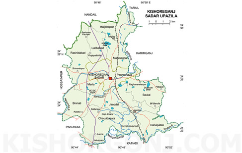
Kishoreganj Sadar Upazila (kishoreganj district) with an area of 193.73 sq km, is bounded by nandail upazila on the north, pakundia and katiadi upazilas on the south, karimganj and tarail upazilas on the east and hossainpur and Nandail upazilas on the west. Main river is Narsunda.
Kishoreganj (Town) consists of 9 wards and 56 mahallas. Kishoreganj municipality was established in 1869. The area of the town is 19.57 sq km. It has a population of 77165; male 52.51%, female 47.49%. The density of population is 3943 per sq km. Literacy rate among the town people is 59%. It has two dakbungalows.
Administration Kishoreganj thana, now an upazila, was established in 1860. It consists of 15 union parishads, one municipality, 9 wards, 125 mouzas and 205 villages.
Historical event During the War of Liberation in 1971 the Pakistan army brutally killed 360 innocent people at Baraitala of Jashadal.
Marks of War of Liberation Mass killing site: Baraitala of Jashadal.
Population 300337; male 51.52%, female 48.48%; Muslim 80%, Hindu 18%, Christian 0.5% and others 1.5%.
Religious institutions Mosque 245, tomb 1, temple 21, church 1, most noted of which are Shahidi Mosque, Pagla Mosque, Haibangnagar Mosque, Tomb of Nizamuddin Aoulia at Katiarchar.
Literacy and educational institutions Average literacy 28.30%; male 33.9% and female 22.3%. Educational institutions: college 5, high school 29, technical institute 1, madrasa 66, government primary school 91, non-government primary school 56; noted old institutions: Kishoreganj Gurudayal College (1943), Government Mohila College (1969).
Locally published newspapers and periodicals Dailies: Ajker Desh, Weekly Shuruk and Narasunda, monthly Al Hasan, fortnightly Sristi O Sob Aunkur, Nel Kantha, Kishorekatha, Krisi Katha (irregular); extinct: Arya Gaurav (1925), Kishoreganj Batrabaha, Kishoreganj Batra (1946), Natun Bangla (1972).
Cultural organisations Club and library 15, cinema hall 6, cultural organisation 15, literary society 10.
Main occupations Agriculture 35.77%, agricultural labourer 17.56%, wage labourer 3.41%, industry 1.22%, business 15.22%, transport 4.97%, construction 1.57%, service 8.72%, others 11.56%.
Land use Total cultivable land 13766 hectares, khas land 69 hectares; single crop 17.65%, double crop 60% and treble crop land 22.35%; land under irrigation 3239 hectares.
Value of land The market value of the land of the first grade is Tk 12000 per 0.01 hectare.
Main crops Paddy, jute, wheat, mustard seed, onion, potato, brinjal, betel leaf and vegetables.
Extinct or nearly extinct crops Indigo, linseed, kaun, arahar and jute.
Main fruits Mango, banana, jackfruit, litchi, guava and black berry.
Fisheries, dairies, poultries Poultry 66, fishery 43, hatchery 10.
Communication facilities Roads: pucca 95 km, mud road 985 km; railways: 18 km; rail station 3, bus terminal 4.
Traditional transport Palanquin, horse carriage. These means of transport are either extinct or nearly extinct.
Manufactories Textile mill 3, rice mill 67, printing press 18, oil mill 7, saw mill 15, ice factory 6, welding 35, homeopathic manufacturing 10.
Cottage industries Bamboo work 60, goldsmith 75, blacksmith 30, potteries 45, wood work 235.
Hats, bazars and fairs Hats and bazars are 32, most noted are Old Thana Hat, Kachari Bazar, Bara Bazar, Sadullah Bazar, Nilganj Bazar, Lakshmiganj Bazar, Boulai Bazar, Gpsai Bazar; fairs 5 (Jhulun Mela, Baishaki Mela, Krisi Mela, Boi Mela and Shishu Mela).
Main exports Jute and leather.
NGO activities Operationally important NGOs are brac, asa, proshika, UNDP and Global Village.
Health centres Hospital 5, upazila health complex 1, family planning clinic 10 and maternity centre 1. [Hakim Md. Fazlur Rahman]