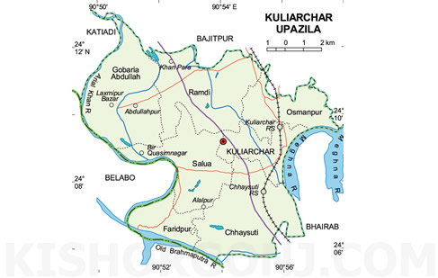
Kuliarchar Upazila (kishoreganj district) with an area of 104.01 sq km, is bounded by bajitpur upazila on the north, belabo and bhairab upazilas on the south, Bhairab and Bajitpur upazilas on the east, katiadi and Belabo upazilas on the west. Main rivers: meghna, old brahmaputra and arial khan; Beel 5.
Kuliarchar (Town) consists of 9 wards and 37 mahallas. It has an area of 3.45 sq km and a population of 28027; male 50.65%, female 49.35%; density of population is 8124 per sq km. Literacy rate among the town people is 28.8%.
Administration Kuliarchar thana was established in 1921 and was turned into an upazila in 1984. The upazila consists of one municipality, 9 wards, 7 union parishads, 46 mouzas and 131 villages.
Historical event During the War of Liberation on 14 August 1971 an encounter was held between the freedom fighters and the Pak army in which four Pakistan soldiers and 28 Razakars surrendered to the freedom fighters along with their arms and ammunitions.
Population 133327; male 50.61%, female 49.39%.
Religious institutions Mosque 210, temple 16, sacred place 1.
Literacy and educational institutions Average literacy 21.6%; male 26.9% and female 16%. Educational institutions: college 1, high school 9, junior high school 1, madrasa 10, government primary school 55, non-government primary school 14; noted institutions: Kishoreganj Gurudayal College (1943), Government Mohila College (1969).
Locally published newspapers and periodicals Monthly Bhatir Darpan.
Cultural organisations Club 45, cinema hall 2, co-operative society 189.
Main occupations Agriculture 51.54%, fishing 1.88%, agricultural labourer 15.66%, wage labourer 2.39%, transport 1.93%, commerce 12.15%, service 4.37%, others 10.08%.
Land use Total cultivable land 8470 hectares, fallow land 819 hectares; single crop 7.68%, double crop 82.10% and treble crop 10.22%; land under irrigation 3239 hectares.
Land control Among the peasants, 22.38% are landless, 22.71% marginal, 35.54% small, 28.29% intermediate and 1.08% rich.
Value of land The market value of the land of the first grade is Tk 7000 per 0.01 hectare.
Main crops Paddy, wheat, mustard seed, potato, peanut and vegetable.
Extinct or nearly extinct crops Jute and varieties of pulse.
Main fruits Mango, banana, jackfruit, litchi.
Communication facilities Roads: pucca 30 km and mud road 501 km; railways 11 km.
Traditional transport Palanquin, horse carriage and bullock cart. These means of transport are either extinct or nearly extinct.
Manufactories Cold storage 1, chess production mill 1, ice factory 9, feed mill 1 and oil mill 1.
Cottage industries Bamboo work 20, goldsmith 115, blacksmith 102, potteries 60, brass work 10 and cotton work 120.
Hats, bazars and fairs Hats and bazars are 8, most noted are Kuliarchar, Dumarkandha, Agarpur, Banglabazar, Choumuri Bazar Jafrabad Haut; fairs 2 (Austami Snana Mela and Dumarkandha Mela).
Main exports Fish, banana, litchi, vegetables.
NGO activities Operationally important NGOs are brac, asa, proshika, Usa, Daus and Global Village.
Health centres Upazila health complex 1, family planning centre 5, rural health centre 4 and veterinary hospital 1. [Md. Abul Kashem Bhuiyan]