

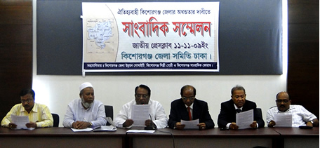
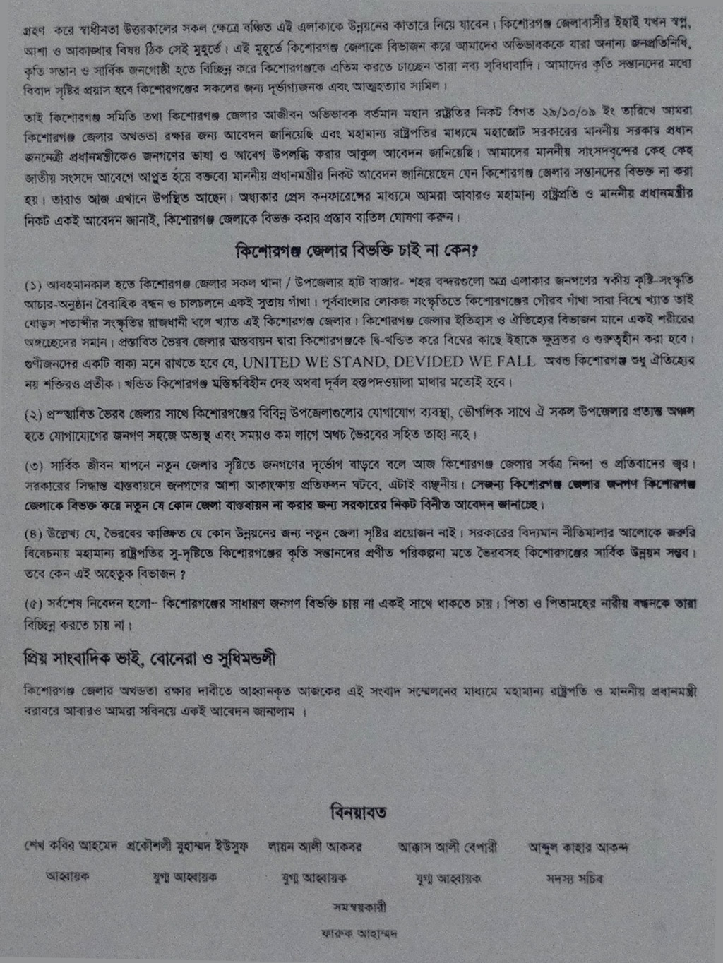
Download press conformance briefing : Download : Page 1 , Download : Page 2
In the ancient time Kishoreganj area was included in the kingdom of the Kamrupa. In the 11th and 12th century the Pala, Varman and Sena kings ruled this area or part of it. After that there arose petty independent kingdoms under the Koch, Hajong, Garo and Rajbanshi. Although in 1491 AD the greater part of Mymensingh was included within the Muslim rule under Firoz Shah, Kishoreganj remained outside. Greater part of Kishoreganj was included in the Mughal Empire during the rein of the Mughal Emperor akbar. But some areas including Jangalbari and egarasindhur remained under the Koch and Ahom kings. In 1538 AD the Ahom king of Egarasindhur was defeated by the Mughals and in 1580 the Koch Chief of Jangalbari was defeated by isa khan. The episode of the conflict between the Mughal Commander Man Singh and Isa Khan, the Chief of the bara-bhuiyans in 1580 and the defeat of Man Singh at Egarasindhur are still current. Though after the death of Isa Khan in 1599 the grater part of Kishoreganj was still under the rule of his son musa khan, ultimately seceded to the Mughals.
Jangalbari fort (fifteenth century), egarasindhur fort (fifteenth century), sadi mosque (1652), Salanka Jame Mosque at Pakundia, Gurai Mosque at Bajitpur (1680), Kutub Shah Mosque at Austagram (1538), Jawar Saheb Bari Mosque at Tarail (1534), Badshahi Mosque at Itna (seventeenth century), Bhagalpur Dewan Bari Mosque at Bajitpur (eighteenth century), Sekandarnagar Mosque at Tarail (eighteenth century), Hazrat Samsuddin Bokhari Mosque Kurikhai at Katiadi (1005), Chandrabati Shiva Mondir (sixteenth century), Delhi Akhra at Mithamain, Arabic stone inscription discovered at village Ghagra, Nataraj Shiva Sculpture discovered at Nikli (fourteenth century), Krishnadas' deed for Nandakishore Pramanik discovered at Kishoreganj Sadar (1759).
Kishoreganj District (dhaka division) with an area of 2688.62 sq km, is bounded by netrokona and mymensingh districts on the north, narsingdi district on the southwest and brahmanbaria district on the southeast, sunamganj and habiganj districts on the east, gazipur and Mymensingh districts on the west. The soil formation of the district is alluvial sand coming from Brahmaputra, Meghna and other small rivers. The soil is fertile. Annual average temperature- maximum 33.3°C, minimum 12°C; annual rainfall 2174 mm.
There are hills and hillocks on the northern and depressions on southern parts of the district. Main rivers are old brahmaputra, meghna, Kalni, Dhanu, Ghorautra, Baurii, Narasunda, Piyain; main depressions: Humaipur (Bajitpur), Somai (Nikli), Barir (Mithamain), Surma Baula (Nikli), and Tallar Haors (Nikli-Bajitpur-Austagram).
Kishoreganj (Town) consists of 9 wards and 56 mahallas. Kishoreganj municipality was established in 1869. The area of the town is 19.57 sq km. It has a population of 77165; male 52.51%, female 47.49%. The density of population is 3943 per sq km. Literacy rate among the town people is 59%. It has two dakbungalows.

News Paper
Daily Ajker Desh, Grihakon Bhatir Darpan, Pratahik Chitra; extinct: Weekly Aryagaurava (1904), Kishoreganj Batrabaha (1924), Akhtar (Urdu, 1926), Kishoreganj Batra (1946), Prativa (1952), Natun Patra (1962), Fortnightly Narasunda (1981), Grambangla (1985), Sristi (1986), Sakal (1988), Suchana (1990), Kishoreganj Parikrama (1991), Manihar (1991), Kishoreganj Prabaha (1993), Bibarani (Kuliarchar 1993) Bajitpur Shamachar().
River
Old brahmaputra, meghna, Kalni, Dhanu, Ghorautra, Baurii, Narasunda, Piyain; main depressions: Humaipur (Bajitpur), Somai (Nikli), Barir (Mithamain), Surma Baula (Nikli), and Tallar Haors (Nikli-Bajitpur-Austagram).